The Best Weather API for Consumer-Facing Services
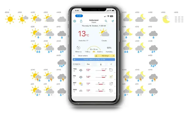
Weather Apps Powered by Foreca Weather Data
Delight Your Users with Weather Data
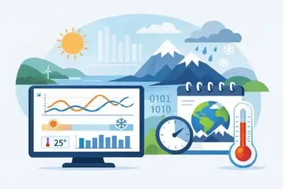
The Foreca Weather API offers reliable data you can use to create your own weather media, provide additional information to your users, or enhance your AI assistant services.
Create Weather Media
Turn weather into your main business. Build high-quality weather app or website that drives traffic and generates revenue through ads or subscriptions.
Boost Engagement
Upgrade AI Context
Equip your AI assistants and chatbots with real-time, reliable weather intelligence. Bridge the gap for LLMs by providing live data that static training models cannot offer.
Foreca is Consistently Ranked Among the Top 3 Weather Forecasts Globally
Discover why
The Complete Weather Toolkit
Everything you need to create engaging consumer experiences – from rich visuals to hyper-local data. Scroll and click any API feature to see its available API endpoints.
Get Your Weather API Key Today!
Start testing for free – scale to production as you grow.
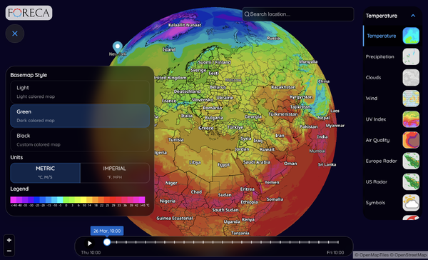
Visualize Weather with Powerful Map Layers
Explore our most popular weather map layers, available as smooth, animated overlays on any standard tile-based map.
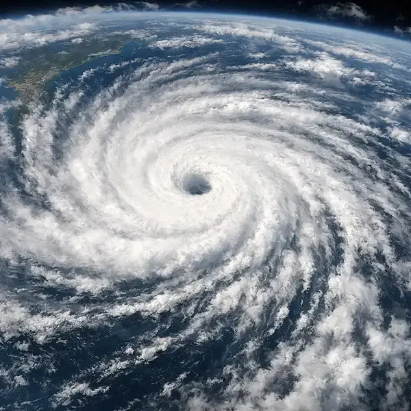
Satellite Images
Global satellite imagery provides a stunning perspective of the entire world on a single map. By monitoring cloud movements over vast areas, users can identify large-scale weather phenomena at a glance, from tracking hurricanes to spotting developing low-pressure systems, and sometimes even estimate their tracks.
UV Index
UV Index maps visualize the strength of ultraviolet radiation using clear color coding, so users can instantly see where sun exposure is low, moderate, or extreme. They help users make informed decisions about sunscreen, shade, and time outdoors.
These maps provide a seamless way to integrate UV data into travel apps, lifestyle news, and outdoor planning tools. Global coverage
Rain Radar
Rain radar displays the real-time movement of precipitation - rain, mixed precipitation, and snow - as detected by weather radar networks. It gives users a highly detailed, up-to-the-minute view of where showers and storms are right now and how they are moving.
The rain radar is ideal for short-term planning and timing. Coverage is limited to areas with radar infrastructure.
Radar Forecast
Precipitation Forecast
Our proprietary forecasting system aggregates and refines data from the world’s leading atmospheric models to ensure maximum precision. While less localized than radar in the immediate short term, they are much more useful for looking hours and days ahead.
Precipitation forecast maps use colored contours to show expected rain, mixed precipitation, and snow. These are typically shown in hourly, 3-hour, or 6-hour steps, with daily totals also available. Global coverage is included.
Cloudiness Forecast
Cloudiness forecast maps use clear color contours to show expected cloud cover—from clear skies to overcast conditions—at a glance. They help users quickly identify when to expect clear conditions, partial clouds, or overcast skies, making them ideal for live broadcasting, solar energy production, and outdoor event planning.
These maps are available globally, providing consistent, high-resolution cloud forecasts for any region in the world.
Wind Speed and Direction
With complete maritime data, these maps are essential for weather storytelling, digital news services, and recreational activities like boating or sailing. Global coverage
Air Quality Index
Air Quality Index maps use intuitive color coding to show air quality levels at a glance, from good to hazardous, so users can immediately see where conditions are safe and where extra caution is needed. This makes it easier to plan outdoor activities, protect sensitive groups, and support health-focused decision-making.
The maps are available globally, giving you a consistent, visual view of air quality for cities and regions all around the world.
Sea Temperature
Sea temperature maps use clear color gradients to show water temperatures at a glance, from colder currents to warm surface waters. They also include land areas for better context, making it easy to understand coastal and offshore conditions in one view.
These maps are available globally, supporting use cases from marine navigation and fisheries to beach tourism and water sports anywhere in the world.
Snow Depth
Approximate snow depth maps use clear color shading to show how much snow is on the ground in different areas, from light dustings to deep cover. At a glance, users can see where conditions are suitable for winter sports, travel, or operations affected by snow.
These maps are available globally, making them useful for ski resorts, logistics, infrastructure planning, and consumer services anywhere in the world.

Air Pressure
Mean sea level air pressure forecast maps show predicted pressure for the coming days, either as contour lines or colored fields. They make it easy to spot key low- and high-pressure centers and follow their movement.
Cloudiness and/or precipitation forecasts are often added on top of contour maps for extra context. Available globally.
Ask for Custom Maps
In addition to the layers listed above, you can request tailored weather maps and fully custom layer combinations to match your specific use case, brand, or product experience.
Adjust colors to fit your visual identity, fine-tune timelines and time steps to your users’ needs, and control how data appears across different zoom levels – our map APIs are built to flex around your design and business requirements, with only a few technical limitations.
Try Weather Maps in Interactive Demo!
All the most popular weather map layers on our live demo with real-time weather data.
Why Choose Foreca Weather API
-
The World’s Best Forecast: Access premium-quality global data that is not only statistically accurate but also appreciated by hundreds of millions end-users worldwide.
-
Easy to Implement: Our developer-friendly API is designed for quick integration, allowing you to go from data to delivery faster.
- Scalable Globally: Let your business grow with Foreca. Our API scales seamlessly with your traffic, content needs, and global reach.
-
First-Class Support: We don’t just hand over a key and disappear; our helpful tech guys provide responsive technical support to ensure your success.
Why Top Developers and Media Brands Choose Foreca?
Foreca is a Strong Choice for Reliable Global Coverage
'The data has been consistently solid, and the support has been especially valuable. Anytime I’ve had a question or needed help troubleshooting an issue, the Foreca team has been quick to respond and easy to work with.'
Brian MuellerFounder and Developer | CARROT Weather (Grailr LLC)
Amazing Technical Support
'Our app users were very happy with the news when we introduced Foreca for the first time. I’d recommend Foreca for its top-notch weather accuracy and amazing technical support.'
Denis DeronjicDeveloper | Overdrop app
The APIs are Reliable and Easy to Work With
'We never had an issue with the reliability of the data. The technical support was always very helpful and quick to answer. The APIs are reliable and easy to work with, and we have the ability to adjust the data to better fit our specific use case.'
Piotr KnapczykFounder and Developer | Weather on the Way app
Well‑Suited to the Needs of a National News Publisher
'Foreca offers a refined, reliable product supported by a team that is consistently responsive and professional. This service has strengthened the quality and reliability of our weather coverage.'
Luke Cassidy, Digital Production Editor &Acting Editor Digital Development | The Irish Times
We Benefit from Excellent Technical Support with Fast Responses
'The forecasts are reliable and accurate globally. Because Foreca provides reliable forecasts all over the world, we never had to worry about geographical gaps in our data.
Athos PerentosFounder | Machapp Software Ltd
Regarding support, it feels more like a partnership
'The primary driver was forecasting accuracy and service uptime; we don’t like to explain to our customers over a support line why things are not working. Foreca service is very reliable. Foreca is stable, easy to integrate, and offers the most accurate rain, snow, and mixed precipitation information on weather radar'
Marcin KrakowiakFounder and Developer | Byssmobile
Easy to Integrate Forecasts into Various Products and Services.
'Their use of MMM/MOS models also contributes to stable and useful forecasts, which makes them a reliable data partner. What we appreciate most in the collaboration with Foreca is their availability and solution-oriented way of working.'
Malin BrinktellCEO | Klart (Schibsted Media)
DOCUMENTATION
Everything You Need to Build Fast and Effortlessly
Our developer portal is comprehensive and packed with practical examples. Whether you are looking for specific endpoint parameters or authentication guides, you will find it all in one place on developer.foreca.com.
What you will find in our docs:
- Full API Reference: Detailed parameters for current weather, hourly forecasts, historical data, maps, and more.
- Easy-to-Follow Guides: Learn how to use endpoints, weather symbols, create your API key, and handle attribution.
- Interactive Maps: Try different example map layers in an interactive demo.
MY API PORTAL
Track Your API Calls and Usage in Real Time
API Updates
Subscribe directly or start with a free 30-day trial
No Credit Card Required.
What data sources does Foreca use?
Is Foreca more accurate than GFS or ECMWF?
How often is Foreca's data updated?
The most local and immediate forecasts, which we call Nowcast, are updated in real time by using radar and satellite data. Our global forecast models are updated multiple times a day.
How Foreca attribution boosts my business?
Including Foreca attribution is not just a technical requirement – it also enhances your own product's credibility.
We have 30 years of experience in the industry. From presence in both B2B and B2C markets, we know that weather is a matter of trust. Attributing the Foreca brand will
instantly transfer the trust established in our brand to yours and allow you to signal to your customers that you’re a high-end solution that invests in the best possible components.
How does the API work?
The Foreca Weather API is easy to use. For maximal flexibility, weather data can be queried from our servers by either coordinates or location names. API responses come in the JSON format, and other formats are also available as a custom solution.
Check out our API documentation here.
For which time steps can I find the weather information?
Foreca Weather API includes:
-
Most recent observations from weather stations around the globe
-
Current weather estimate based on the observations and forecast model.
-
15-minute Forecast up to next 3 hours
-
Hourly Forecast up to next 7 days
-
Daily Forecast up to next 14 days
See more in the API Documentation.
Which are the weather parameters provided?
All the commonly used weather parameters are provided. Visit our API Documentation for a full list of parameters.
How can I add weather maps to my app?
In addition to point forecasts, Foreca Weather API includes weather maps. See all available layer in weather maps documentation. You can also find an interactive weather map demo here.
How does the Foreca Map API work?
The API serves map layers as tiles. A tile is a square image that is laid on the map. As the user moves around the map, zooms in and out, or moves a time slider, new tiles need to be requested from the Tile endpoint.
Sounds complicated, but typically, much of the logic is handled by a map library that your app uses.
The Capabilities endpoint reports the temporal and spatial availability of tiles for a specific layer, as well as available color schemes.
I want to add Governmental Weather Warnings to my app, is it possible?
Yes! Each country issues alerts in its own way, but luckily, Foreca standardizes them into unified categories in one global feed – so you don’t have to collect different formats or harmonize the data yourself.
You can find more information about the warnings in here.
Can I use Foreca Weather API if my project isn't for consumers?
Yes, our API is a high-performance solution for any business need, including internal operations, logistics, etc. Our underlying premium-quality global weather data remains the same regardless of your use case.
Our API is a perfect fit for:
-
Business Optimization: Streamlining logistics or energy management based on accurate atmospheric data.
-
AI & Research: Providing real-time intelligence for LLMs and internal analytical models.
-
Internal Tools: Enhancing corporate dashboards or software used by your own employees or business partners.
Even if you aren't building a service for consumers, you still benefit from our first-class developer support and an API designed for scalability and ease of implementation. We help you identify the right data sources and deliver them ready-to-use, so you can focus on your core business success. Don't hesitate to contact us for more information.
My question is not listed here
If you have any questions, feel free to contact us. You can also find more API-related FAQs for developers in our documentation.
CONTACT US
We'll Help You to Succeed
Drop us a line with your goals, and our team will be in touch shortly.